Sulzfluh cave trail

Medium
9.9 km
5:00 h
1075 mhd
1075 mhd
Über grüne Matten hoch zum Gemschtobel
Sulzfluh Höhlenwanderung

Show all 7 images

Höhlenwanderung Sulzfluh
Bright limestone fields, dark caves. The discovery tour to the caves of the proud Sulzfluh rock massif offers varied terrain and magnificent color contrasts.
Technique /6
Fitness 3/6
Highest Point  2817 m
Lowest Point  1776 m
Best Season
Jan
Feb
Mär
Apr
Mai
Jun
Jul
Aug
Sep
Okt
Nov
Dez
Start
Berghaus Alpenrösli, Partnun
Destination
Berghaus Alpenrösli, Partnun
Coordinates
46.998149, 9.858099

Details

Description

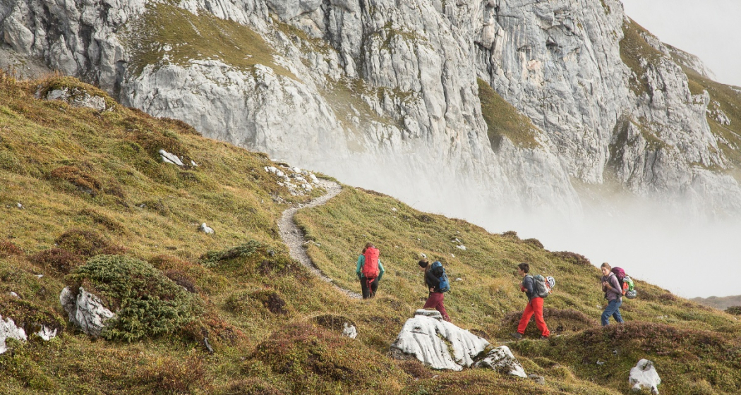
From Partnun you walk over green meadows up to the brightly shining limestone walls of the summit Sulzfluh. Over some rock steps secured with wire ropes you reach the barren, scree-covered Gemstobel. Some exposed spots require surefootedness. With the prominent summit cross in sight, you climb steeply up to the ridge. The detour to the summit of the Sulzfluh (2817 m) is rewarded with a spectacular panorama as far as the Valais Alps and Lake Constance. You hike along the border to Austria in the direction of the Tilisunahütte across an extensive limestone landscape of slabs and pointed ribs. Continue on the alpine section of the trail - good orientation is a prerequisite, as Steimännli (cairns) and only a few markings point the way. Before the counter ascent to point 2446, branch off through a hollow towards the east. Back on Swiss soil, you soon reach the first caves. The Abgrundhöli is reserved for speleologists, as it plunges into the depths right at the beginning. But the Seehöli and Chilchhöli can be explored a bit on your own responsibility (don't forget your headlamp!). Past the caves, the path leads in a steep zigzag down to the Tritt (2043 m). From here you continue on the mountain hiking trail (white-red) past the Partnun lake back to Partnun.

Alternative: If you want even more rock contact, replace the ascent through the Gemschtobel with the via ferrata Sulzfluh.

Geheimtipp

The homemade cake in the restaurants Alpenrösli and Sulzfluh replenishes the energy reserves.

Sicherheitshinweis

The trail is classified as T4 (alpine hiking) on the section between the "Karrenfeld" and the caves - there are few trail markings, good orientation is a prerequisite (if marked: white-blue-white, according to the SAC hiking scale). The other trail sections are classified as challenging mountain hiking trail (T3-T3+, marked: red-white).

Path / Terrain: Path not visible everywhere, route partly pathless, crags, partly exposed.Requirements: Familiarity with exposed terrain, sturdy trekking shoes, good orientation skills.

About the caves - exploring the caves is at your own risk. It is recommended to go with experienced persons (mountain guides, speleologists). Even with little fresh snow, the entrances are prone to snow slides.

Ausrüstung

Sturdy mountain boots, mountain hiking clothes suitable for the season. An up-to-date hiking map in your backpack is just as advisable as protection against the sun, rain and heat, a water bottle and provisions for the tour. Touring poles increase surefootedness and take the strain off your joints. For emergencies: first aid kit, emergency blanket, cell phone. In addition, a compass and altimeter may be advisable.

Directions

Partnun - Gemschtobel - Sulzfluh (2817 m) - Karrenfeld - Chilchhöhli - Seehöhli - Tritt - Partnunsee - Partnun

Directions

Public Transport

Take the train to Küblis. Change directly to the post bus in the direction of St. Antönien, as far as St. Antönien Sagaris. In St. Antönien, Sagaris change to the Bus alpin(reservation required) and continue to the terminus Partnun, Berghaus Alpenrösli (minus 0.5h walking time).

Anreise Information

Via the A13 freeway to Landquart, continue on the N28 national road in the direction of Davos / Vereina. In Küblis leave the national road and turn left after the traffic circle at the entrance to the village in the direction of Luzein, Pany, St. Antönien. Follow the mountain road to St. Antönien, continue through the village to Rüti. In direction Partnun until the last parking lot P6 in Garstett.

Parken

In St. Antönien, all parking spaces are subject to a fee. In the parking lots you can pay with cash, Parkingpay app, Easy-Park or Twint. The last parking lot P6 Garstett with day ticket is located below Partnunstafel, about 3.5 km outside of St. Antönien.

The parking lot below the restaurants Alpenrösli & Sulzfluh is reserved for the house guests.

Responsible for this content Prättigau Marketing.
This content has been translated automatically.

Outdooractive Logo

This website uses technology and content from the Outdooractive platform.